
| Photo of the month – February 2013 |
[German version] |
|
The dull days of winter provide an ideal opportunity for reflecting on the curiosities of life on land and sea. And so, we have two photos of the month for you this month. |
|
|

|
| Potemkin end wall | Diving lessons – or the necessity of navigation |
|
Diving lessons – or the necessity of navigation In our title, we have taken some liberties with the words of Gnaeus Pompeius, "navigare necesse est vivere non est necesse" (to sail is necessary; to live is not necessary). Whenever a mariner sets off on a voyage, whether it be on a container ship, tanker, a sailing vessel or a motor yacht, for professional reasons, as a sport or as a hobby, it is their bounden duty to plan the voyage. Having ensured that there is sufficient fuel, water etc. on board, one of the most important tasks is to consult the navigation charts, to plot a course and identify any regions that are to be avoided at all costs because of the presence of shallows, for instance. Depending on the safety-consciousness of the navigator responsible, safe corridors of varying size will be defined and plotted on the nautical charts or the course will be plotted accordingly, and the voyage can begin. 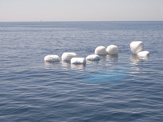 Figure 1 [Stefan Zucker] Safe corridors are defined primarily on the basis of the opportunities for navigation that are available. If the region is simple in respect of navigation, for instance if a bearing can be taken to determine the distance from the coast and thus identify the vessel’s position, it is possible to define smaller safe corridors. If the region does not permit such reliable navigation, the safe corridors will be that much larger. Nautical charts of the appropriate scale and level of detail, whether in electronic or on paper must be available to plan the voyage and during the voyage itself. This is the only safe way of planning a sea voyage. 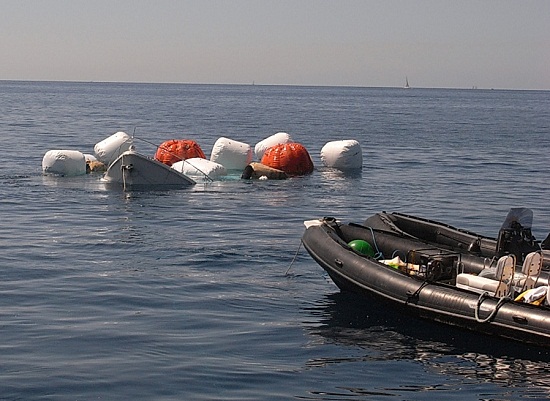 Figure 2 [Stefan Zucker] In this case, a motor yacht collided with a rock just under the surface near the coast. The yacht sank in 30 m of water. 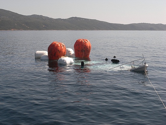 Figure 3 [Stefan Zucker] The cause was inadequate navigation and insufficient planning of the voyage and the course. A nautical chart plotter was being used for navigation. Because the planned destination was a considerable distance away, a large scale was quickly chosen so that the screen used to display the nautical chart was also able to display the destination. It is clear that neither the voyage nor the course had been planned. The shallows near to the coast were not shown at the scale selected for the chart. This accident happened despite GPS positioning, which is updated every couple of seconds, and the theoretical possibility of using the correct scale, which would have allowed the shallows to be identified without difficulty. Anyone who navigates close to a coast with a rocky seabed without planning their course in sufficient detail beforehand and, if necessary choosing a different and safer course, is violating the fundamental principles of good seamanship. 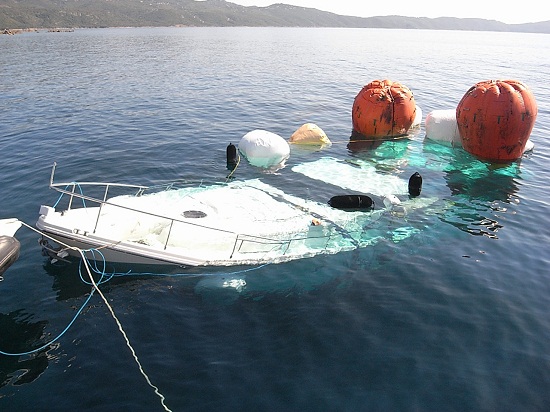 Figure 4 [Stefan Zucker] The IMO’s SOLAS Convention for the Safety of Life at Sea describes how the planning of a voyage is one of the fundamental duties of good seamanship, even for sport vessels. Failure to comply with this is a serious dereliction of duty on the part of the master of the vessel. 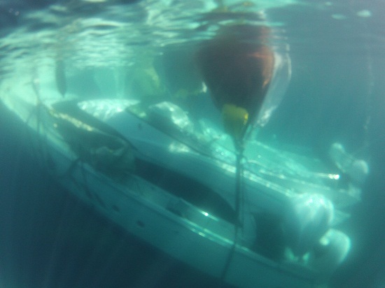 Figure 5 [Stefan Zucker] Apart from the limited salvage value, this vessel is a total write-off. 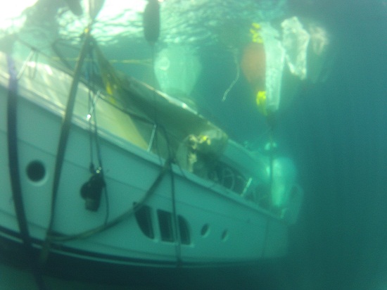 Figure 6 [Stefan Zucker] Whether or not the hull insurance will cover the complex salvage operation, carried out for environmental reasons, will depend on the precise terms of the policy. One thing is clear. Claims such as this can be avoided. Back to beginning |